Grass Terrain: Difference between revisions
mNo edit summary |
Qwertyxp2000 (talk | contribs) |
||
| (8 intermediate revisions by 4 users not shown) | |||
| Line 1: | Line 1: | ||
{{BMC terrain info | {{BMC terrain info | ||
|id F=GrassTerrain | |id F=GrassTerrain | ||
| Line 5: | Line 5: | ||
|name =Grass Terrain | |name =Grass Terrain | ||
|image F= | |image F=BMCF Grass terrain icon.svg | ||
|image M= | |image M= | ||
| Line 12: | Line 12: | ||
|music =Street Party | |music =Street Party | ||
}} | }} | ||
'''Grass Terrain''' is a type of [[Terrain (BMC)|Terrain]] in ''[[Bloons Monkey City]]''. | '''Grass Terrain''' is a type of [[Terrain (BMC)|Terrain]] in ''[[Bloons Monkey City]]''. It is the most common terrain type, with no restricted towers. | ||
{{TOC}} | {{TOC}} | ||
{{clear|right}} | {{clear|right}} | ||
| Line 21: | Line 21: | ||
{{BMC track info | {{BMC track info | ||
|id F=Grass1 | |id F=Grass1 | ||
|id M= | |id M=level_Grass1Def | ||
|name =Tutorial | |name =Tutorial | ||
| Line 33: | Line 33: | ||
|tunnels =0 | |tunnels =0 | ||
|water =No | |water =No | ||
|path lengths F=1737.61 | |path lengths F=1737.61 | ||
|path lengths M=1152.09 | |path lengths M=1152.09 | ||
}} | }} | ||
This vertically symmetrical map has a track going from northwest to southeast, making plenty of right angle turns in the process. This track is played during the tutorial of the game. | |||
{{clear|right}} | {{clear|right}} | ||
| Line 44: | Line 42: | ||
{{BMC track info | {{BMC track info | ||
|id F=Grass2 | |id F=Grass2 | ||
|id M= | |id M=level_Grass2Def | ||
|name =UO | |name =UO | ||
| Line 56: | Line 54: | ||
|tunnels =0 | |tunnels =0 | ||
|water =No | |water =No | ||
|path lengths F=2137.58 | |path lengths F=2137.58 | ||
|path lengths M=1401.91 | |path lengths M=1401.91 | ||
}} | }} | ||
This map has a track which, after starting in the northwest corner, makes three large, vertical, parabolic turns, creating two large fields for tower placement in the process. | |||
{{clear|right}} | {{clear|right}} | ||
| Line 67: | Line 63: | ||
{{BMC track info | {{BMC track info | ||
|id F=Grass3 | |id F=Grass3 | ||
|id M= | |id M=level_Grass3Def | ||
|name =Pistol | |name =Pistol | ||
| Line 79: | Line 75: | ||
|tunnels =1 | |tunnels =1 | ||
|water =No | |water =No | ||
|path lengths F=2162.05 | |path lengths F=2162.05 | ||
|path lengths M=1284.37 | |path lengths M=1284.37 | ||
}} | }} | ||
Consisting mostly of straightaways with a few right angle turns, this map first goes north through a tunnel before turning east, than running parallel to the east edge of the map, and finally exiting in a staircase-like fashion to the northwest. | |||
{{clear|right}} | {{clear|right}} | ||
| Line 90: | Line 84: | ||
{{BMC track info | {{BMC track info | ||
|id F=Grass4 | |id F=Grass4 | ||
|id M= | |id M=level_Grass4Def | ||
|name =Flower | |name =Flower | ||
| Line 102: | Line 96: | ||
|tunnels =0 | |tunnels =0 | ||
|water =No | |water =No | ||
|path lengths F=3487.77 | |path lengths F=3487.77 | ||
|path lengths M=2103.03 | |path lengths M=2103.03 | ||
}} | }} | ||
This map has a symmetrical flower pattern created by five curves that each follow most of the circumference of a circle. | |||
{{clear|right}} | {{clear|right}} | ||
| Line 113: | Line 105: | ||
{{BMC track info | {{BMC track info | ||
|id F=Grass5 | |id F=Grass5 | ||
|id M= | |id M=level_Grass5Def | ||
|name =Clover | |name =Clover | ||
| Line 125: | Line 117: | ||
|tunnels =0 | |tunnels =0 | ||
|water =No | |water =No | ||
|path lengths F=2528.62 | |path lengths F=2528.62 | ||
|path lengths M=1601.58 | |path lengths M=1601.58 | ||
}} | }} | ||
With a more rugged path than other maps of this terrain type, the path of this map, after emerging from the west, makes small loops in the north, east, and south before a final straightaway parallel to its first. | |||
{{clear|right}} | {{clear|right}} | ||
| Line 136: | Line 126: | ||
{{BMC track info | {{BMC track info | ||
|id F=Grass6 | |id F=Grass6 | ||
|id M= | |id M=level_Grass6Def | ||
|name =Tunnels | |name =Tunnels | ||
| Line 153: | Line 143: | ||
|path lengths M=1836.41,1982.85 | |path lengths M=1836.41,1982.85 | ||
}} | }} | ||
The path of this map swerves under an overpass, constantly turning around, before reaching the east and splitting into two horizontal paths west, one of which goes over the tunnels. | |||
{{clear|right}} | {{clear|right}} | ||
===Weight=== | ===Weight=== | ||
{{BMC track info | {{BMC track info | ||
|id M= | |id M=level_Grass7Def | ||
|name =Weight | |name =Weight | ||
| Line 169: | Line 159: | ||
|tunnels =0 | |tunnels =0 | ||
|water =Yes | |water =Yes | ||
|path lengths M=1523.32 | |path lengths M=1523.32 | ||
}} | }} | ||
Vertically symmetrical, this map features a primarily horizontal path and two lakes which can fit three water towers each. | |||
{{clear|right}} | {{clear|right}} | ||
=== | ===Cubes=== | ||
{{BMC track info | {{BMC track info | ||
|id M= | |id M=level_Grass8Def | ||
|name = | |name =Cubes | ||
|image M=BMCM thumb_level_Grass8Def.png | |image M=BMCM thumb_level_Grass8Def.png | ||
| Line 189: | Line 177: | ||
|tunnels =0 | |tunnels =0 | ||
|water =Yes | |water =Yes | ||
|path lengths M=1348.01 | |path lengths M=1348.01 | ||
}} | }} | ||
This map stumbles from northwest to southeast using only right angles and two loops. The southwest of this map is a large lake. | |||
{{clear|right}} | {{clear|right}} | ||
===Shelves=== | ===Shelves=== | ||
{{BMC track info | {{BMC track info | ||
|id M= | |id M=level_Grass9Def | ||
|name =Shelves | |name =Shelves | ||
| Line 209: | Line 195: | ||
|tunnels =0 | |tunnels =0 | ||
|water =Yes | |water =Yes | ||
|path lengths M=1471.09 | |path lengths M=1471.09 | ||
}} | }} | ||
The map features two corridors on the north and south end which the path circumnavigates, and a large open area with a lake in the northeast large enough for five water towers. | |||
{{clear|right}} | {{clear|right}} | ||
| Line 229: | Line 213: | ||
|tunnels =0<!-- no, the entrance is not considered a tunnel --> | |tunnels =0<!-- no, the entrance is not considered a tunnel --> | ||
|water =No | |water =No | ||
|path lengths F=2994.66 | |path lengths F=2994.66 | ||
}} | }} | ||
Only appearing in the Bloon Dunes, this map mostly comprises a spiral path that loops 3 times with no space for towers in between before abruptly ducking into a tunnel. | |||
{{clear|right}} | {{clear|right}} | ||
==Strategy== | |||
With exception of Tunnels, and sometimes Pistol, Grass is an easy terrain, having no restrictions on tower types except for lack of water on most (all in the Flash version). Many of these tracks contain decent curves and bends that are suitable for a variety of strategies. Cheaper Aces let [[Spectre (BMC)|Spectre]] become an easier carry and, in the multiplatform version, improve cheap Ceramic control via [[Bloonchipper (BMC)|Bloonchipper]] spam. Be aware of tunnels, which can shield Bloons from damage. For the Tunnels track, it is advised to focus the defense around the middle sections of the pathing, instead of clumping towers into only one area where the path split would be a detriment, and avoid relying on one tower to cover both exits. | |||
==Gallery== | |||
<gallery> | |||
File:BMCM max buccaneers on shelves.png|Maximum Monkey Buccaneer and Monkey Sub placements on Shelves (5) | |||
File:BMCM max buccaneers on weight.png|Maximum Monkey Buccaneer and Monkey Sub placements on Weight (6) | |||
</gallery> | |||
==Navigation== | ==Navigation== | ||
{{BMC terrain nav}} | {{BMC terrain nav}} | ||
Latest revision as of 00:36, 28 September 2026
| Grass Terrain | |||||||||||||||
|---|---|---|---|---|---|---|---|---|---|---|---|---|---|---|---|
| |||||||||||||||
| |||||||||||||||


Grass Terrain is a type of Terrain in Bloons Monkey City. It is the most common terrain type, with no restricted towers.
Tracks
[edit | edit source]Tutorial
[edit | edit source]| Tutorial | ||||||||||||||
|---|---|---|---|---|---|---|---|---|---|---|---|---|---|---|
| ||||||||||||||
| ||||||||||||||


This vertically symmetrical map has a track going from northwest to southeast, making plenty of right angle turns in the process. This track is played during the tutorial of the game.
UO
[edit | edit source]| UO | ||||||||||||||
|---|---|---|---|---|---|---|---|---|---|---|---|---|---|---|
| ||||||||||||||
| ||||||||||||||


This map has a track which, after starting in the northwest corner, makes three large, vertical, parabolic turns, creating two large fields for tower placement in the process.
Pistol
[edit | edit source]| Pistol | ||||||||||||||
|---|---|---|---|---|---|---|---|---|---|---|---|---|---|---|
| ||||||||||||||
| ||||||||||||||


Consisting mostly of straightaways with a few right angle turns, this map first goes north through a tunnel before turning east, than running parallel to the east edge of the map, and finally exiting in a staircase-like fashion to the northwest.
Flower
[edit | edit source]| Flower | ||||||||||||||
|---|---|---|---|---|---|---|---|---|---|---|---|---|---|---|
| ||||||||||||||
| ||||||||||||||


This map has a symmetrical flower pattern created by five curves that each follow most of the circumference of a circle.
Clover
[edit | edit source]| Clover | ||||||||||||||
|---|---|---|---|---|---|---|---|---|---|---|---|---|---|---|
| ||||||||||||||
| ||||||||||||||


With a more rugged path than other maps of this terrain type, the path of this map, after emerging from the west, makes small loops in the north, east, and south before a final straightaway parallel to its first.
Tunnels
[edit | edit source]| Tunnels | ||||||||||||||||||||
|---|---|---|---|---|---|---|---|---|---|---|---|---|---|---|---|---|---|---|---|---|
| ||||||||||||||||||||
| ||||||||||||||||||||


The path of this map swerves under an overpass, constantly turning around, before reaching the east and splitting into two horizontal paths west, one of which goes over the tunnels.
Weight
[edit | edit source]| Weight | ||||||||||
|---|---|---|---|---|---|---|---|---|---|---|
| ||||||||||
|

Vertically symmetrical, this map features a primarily horizontal path and two lakes which can fit three water towers each.
Cubes
[edit | edit source]| Cubes | ||||||||||
|---|---|---|---|---|---|---|---|---|---|---|
| ||||||||||
|

This map stumbles from northwest to southeast using only right angles and two loops. The southwest of this map is a large lake.
Shelves
[edit | edit source]| Shelves | ||||||||||
|---|---|---|---|---|---|---|---|---|---|---|
| ||||||||||
|

The map features two corridors on the north and south end which the path circumnavigates, and a large open area with a lake in the northeast large enough for five water towers.
Yo-Yo
[edit | edit source]| Yo-Yo | ||||||||||
|---|---|---|---|---|---|---|---|---|---|---|
| ||||||||||
|

Only appearing in the Bloon Dunes, this map mostly comprises a spiral path that loops 3 times with no space for towers in between before abruptly ducking into a tunnel.
Strategy
[edit | edit source]With exception of Tunnels, and sometimes Pistol, Grass is an easy terrain, having no restrictions on tower types except for lack of water on most (all in the Flash version). Many of these tracks contain decent curves and bends that are suitable for a variety of strategies. Cheaper Aces let Spectre become an easier carry and, in the multiplatform version, improve cheap Ceramic control via Bloonchipper spam. Be aware of tunnels, which can shield Bloons from damage. For the Tunnels track, it is advised to focus the defense around the middle sections of the pathing, instead of clumping towers into only one area where the path split would be a detriment, and avoid relying on one tower to cover both exits.
Gallery
[edit | edit source]-
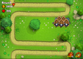 Maximum Monkey Buccaneer and Monkey Sub placements on Shelves (5)
 -
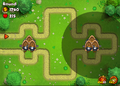 Maximum Monkey Buccaneer and Monkey Sub placements on Weight (6)

